Koungheul Department (Koungheul)
Koungheul is the name of one of 45 departments of Senegal, as well as the name of Koungheul Arrondissement and the commune of Koungheul, the principal settlement of the department.
In 2006, the new Koungheul Department was created as a division of Kaffrine Region, by carving off the eastern half of the Kaffrine Department. For administrative purposes it comprises:
* Koungheul Arrondissement with one commune (town).
* Koungheul
* Ida Moride Arrondissement with three communautés rurales (rural communities).
* Fass Thiékène
* Ida Mouride
* Saly Escale
* Lour Escale Arrondissement with two communautés rurales.
* Lour Escale
Map - Koungheul Department (Koungheul)
Map


Country - Senegal
 |
 |
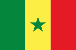
| Flag of Senegal | |
Senegal is notably the westernmost country in the mainland of the Old World, or Afro-Eurasia. It owes its name to the Senegal River, which borders it to the east and north. The climate is typically Sahelian, though there is a rainy season. Senegal covers a land area of almost 197000 km2 and has a population of around million. The state is a unitary presidential republic; since the country's foundation in 1960, it has been recognized as one of the most stable countries on the African continent.
Currency / Language
| ISO | Currency | Symbol | Significant figures |
|---|---|---|---|
| XOF | West African CFA franc | Fr | 0 |
| ISO | Language |
|---|---|
| FR | French language |
| WO | Wolof language |